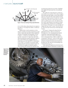
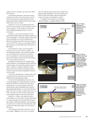
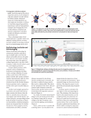
and provides an opportunity to train
and rehearse the inspection (Figure 5).
Recommended Practices for
Robotics-Based Remote Visual
Inspection
Close visual inspection is a top priority
for robotic applications, but there are
discussions about whether robotics-
based remote visual inspection (RVI)
can fully replace close visual inspection
(CVI) performed by a human. Several
RVI limitations have been identified,
including the robot’s distance from
the inspection surface, limited viewing
angles, lack of tactile feedback, absence
of surface preparation or deployment
of inspection aids, and challenges with
artificial lighting. Due to these limita-
tions, it is advised not to claim robotics-
based RVI as a complete replacement for
human CVI. Instead, robotic inspection
should complement conventional CVI
by identifying areas that require further
examination.
Standards such as ASME V Article 9
[6] and BS EN 17637 [7] specify spatial
resolution requirements for CVI and
direct visual inspection (DVI), typi-
cally around 3 line pairs per millimeter
(lp/mm) under optimal viewing con-
ditions, based on human eye acuity.
Although ASME V Article 9 also ref-
erences the visibility of fine lines, this
is not considered a reliable measure
of spatial resolution. To comply with
ASME V Article 9, robotics-based RVI
images should demonstrate a spatial
resolution of approximately 3 lp/mm,
equivalent to that of CVI and DVI.
The “HOIS Guidance on Image
Quality for UAV/UAS–Based External
Remote Visual Inspection in the Oil
&Gas Industry” [5] provides detailed
guidance on maintaining image
quality during uncrewed aerial vehicle
(UAV) inspections within the oil and
gas sector. Its goal is to ensure that
the images obtained are of sufficient
quality for engineering assessments
of component integrity, aiding asset
operators in making critical decisions
about continued operation. While the
HOIS guidance focuses exclusively on
FEATURE
|
ROBOTICVT
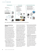
New assets
3D CAD data
Asset in 3D Planning &simulation Inspection &reporting
Old assets
3D CAD data
Universal
2D drawing/
sketch available
Existing CAD
3D asset builder
3D dynamic reconstruction
• Feasibility check
• Mission &inspection planning
• Training &rehearsal
Planning
Simulation
3D digital twin
• 3D spatial awareness at any time
• Geotagging of all data
• 100% repeatablility
• No risk for inspectors
• Automated reporting
Mission execution Mission execution
3D digital twin
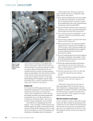
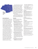
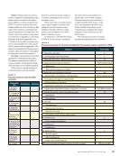
Figure 5. Integrating planning and simulation, using the 3D virtual representation of the asset and the kinematic representation of the robot with
the camera and the cables.
Thermal impact?
Check with operations Thermal impact?
Check with operations
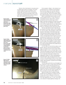
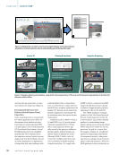
Figure 4. 3D digital twin: (a) editor to amend and complete findings and recommendations,
possibility to annotate inspection data (b) automatically generated inspection report.
52
M A T E R I A L S E V A L U A T I O N • J U L Y 2 0 2 4


